National ASLA Award-Winning Student Projects Imagine New Futures for Virginia's Coastal Communities
We congratulate our students and recent graduates of the School of Architecture's landscape architecture and architecture programs for being recognized by the American Society of Landscape Architects (ASLA). In the recently announced 2026 ASLA Student Awards, three A-School student teams earned Honor Awards for projects addressing some of Virginia's coastal communities' most pressing environmental and cultural challenges. The recipients include Lindsey Messer (MLA ’27), Michael John Minutoli (MLA ’27), and Catelyn Southwell (MLA ’26), who were honored in the Residential Design category for their project Grasses that Glow: Neighborhood Agency through Practices of Care; Sean Alberts (MLA ’25), Sachida Pradhan (MLA ’24), and Shuai Yuan (MLA ’25), who were honored in the Analysis & Planning category for their project Saxis 2090: From Resistance to Resilience through Dredged Landscapes; and Lincoln Landon Lewis (PhD in the Constructed Environment Candidate) and William Packwood (BS Arch ’25), who were honored in the Research category for their project Tangier Island Watermen Working Landscape.
HONOR AWARD—
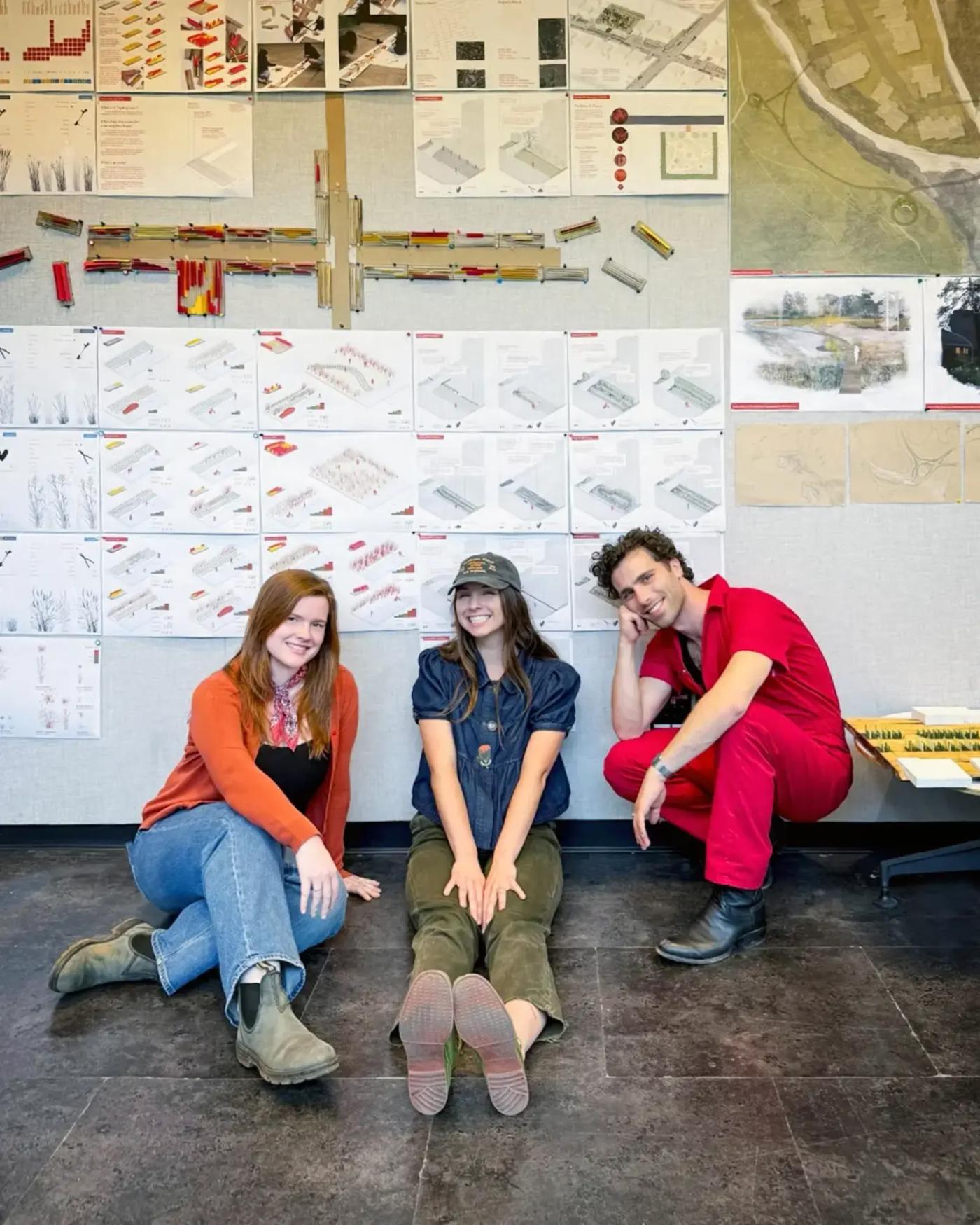
LINDSEY MESSER, MLA '27; MICHAEL JOHN MINUTOLI, MLA ‘27; CATELYN SOUTHWELL, MLA '26
|
Image
|
RESIDENTIAL DESIGN CATEGORY—
GRASSES THAT GLOW: NEIGHBORHOOD AGENCY THROUGH PRACTICES OF CARE
Faculty Advisor—Ruby Zielinski
|
Image
|
Image
|
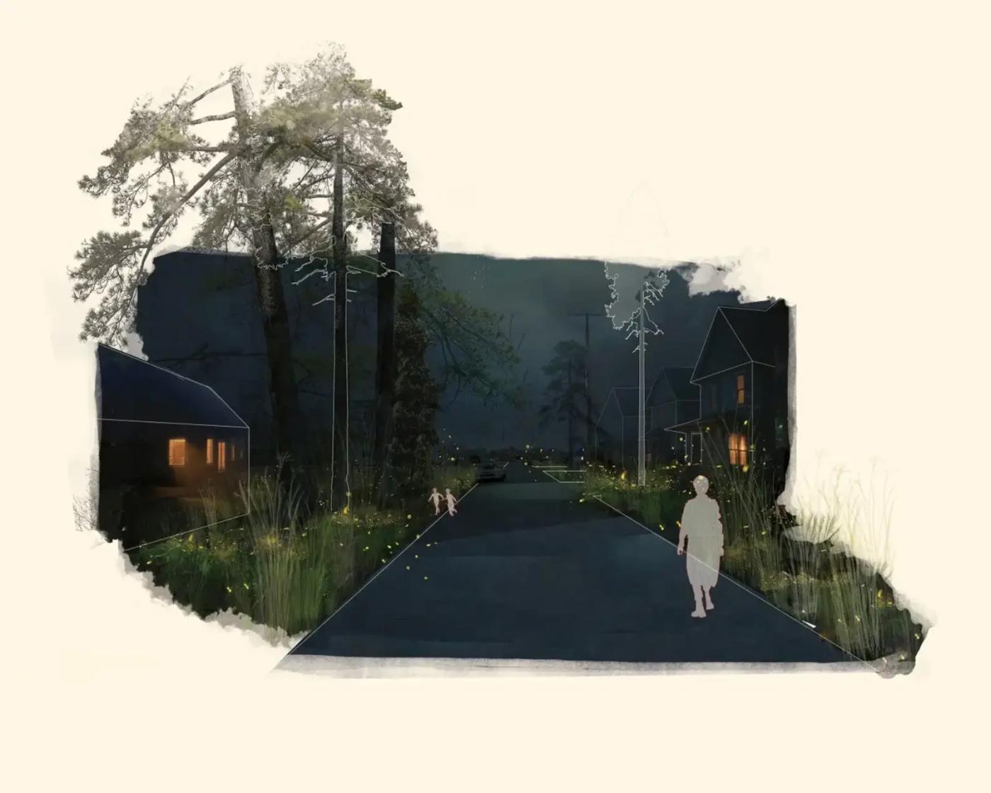
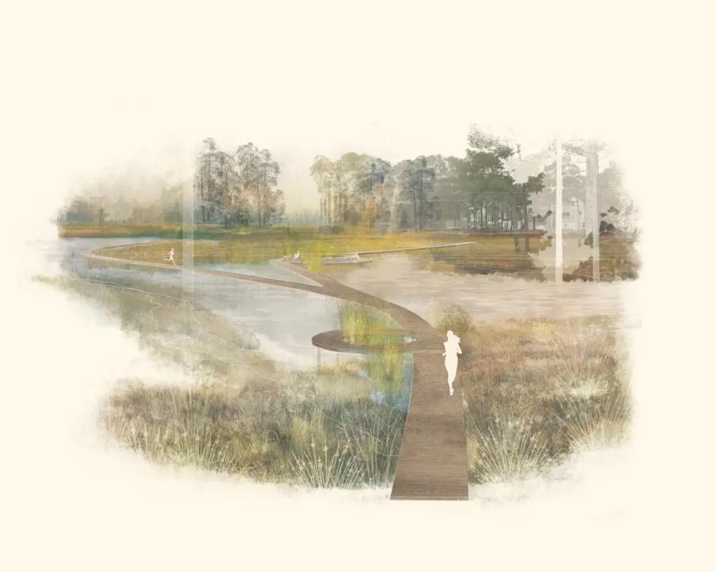
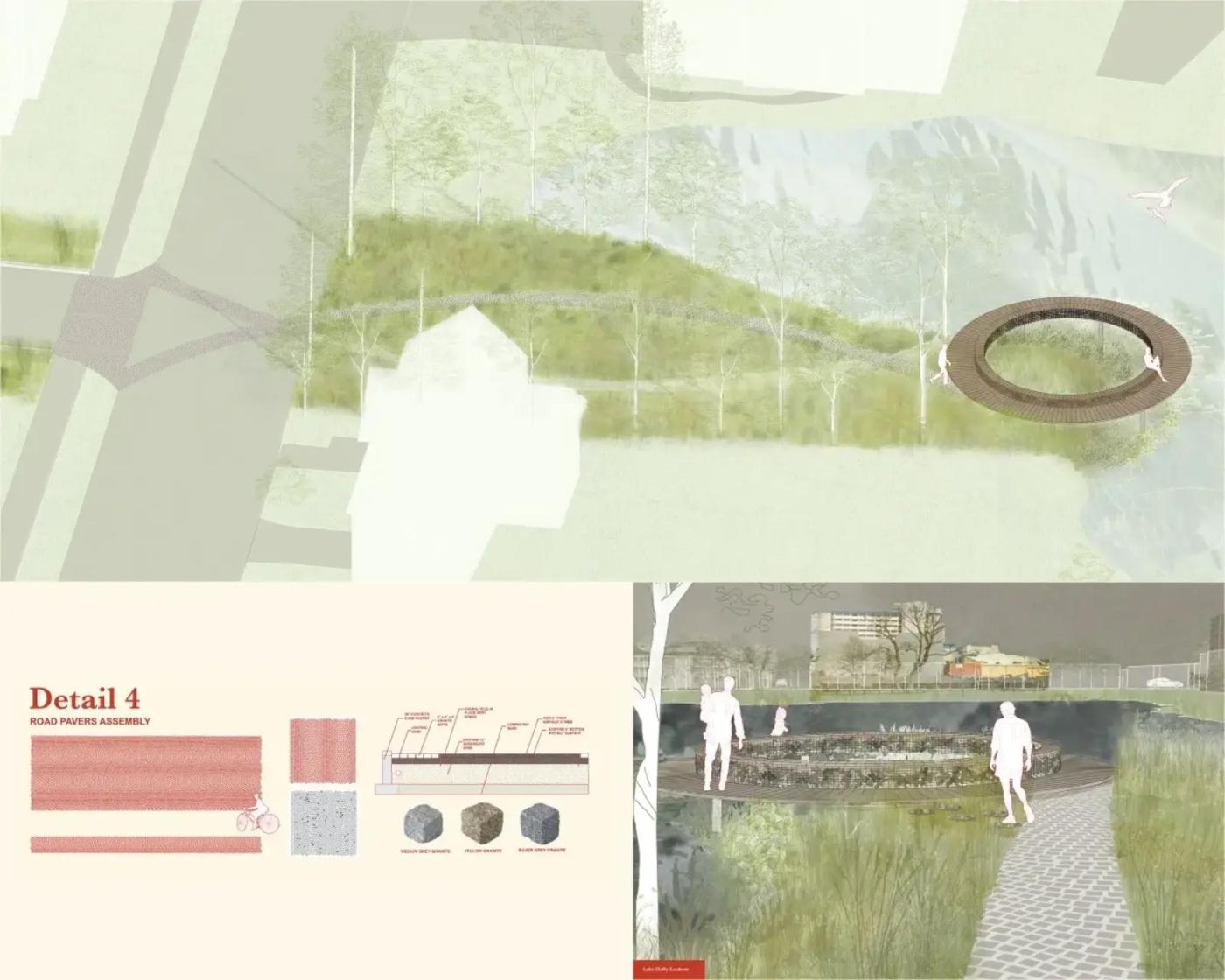
| (left) High Point Avenue—perspective: walking through a firefly lit night on High Point Ave. showing the fruits of restored ecological habitat. (right) Marshview Park—boardwalk connection. © Catelyn Southwell | |
With a focus on Virginia Beach, Grasses that Glow proposes a neighborhood-scaled transformation of High Point Avenue's right-of-way into a continuous native grassland corridor. While regional investment invests in the tourism economy, this project looks inward, to the residents of Shadowlawn, a neighborhood whose encroaching marsh threatens to cut it apart as sea levels rise. This site becomes the canvas for a suite of designs that connect and promote a unified future of ecological health and resilience.
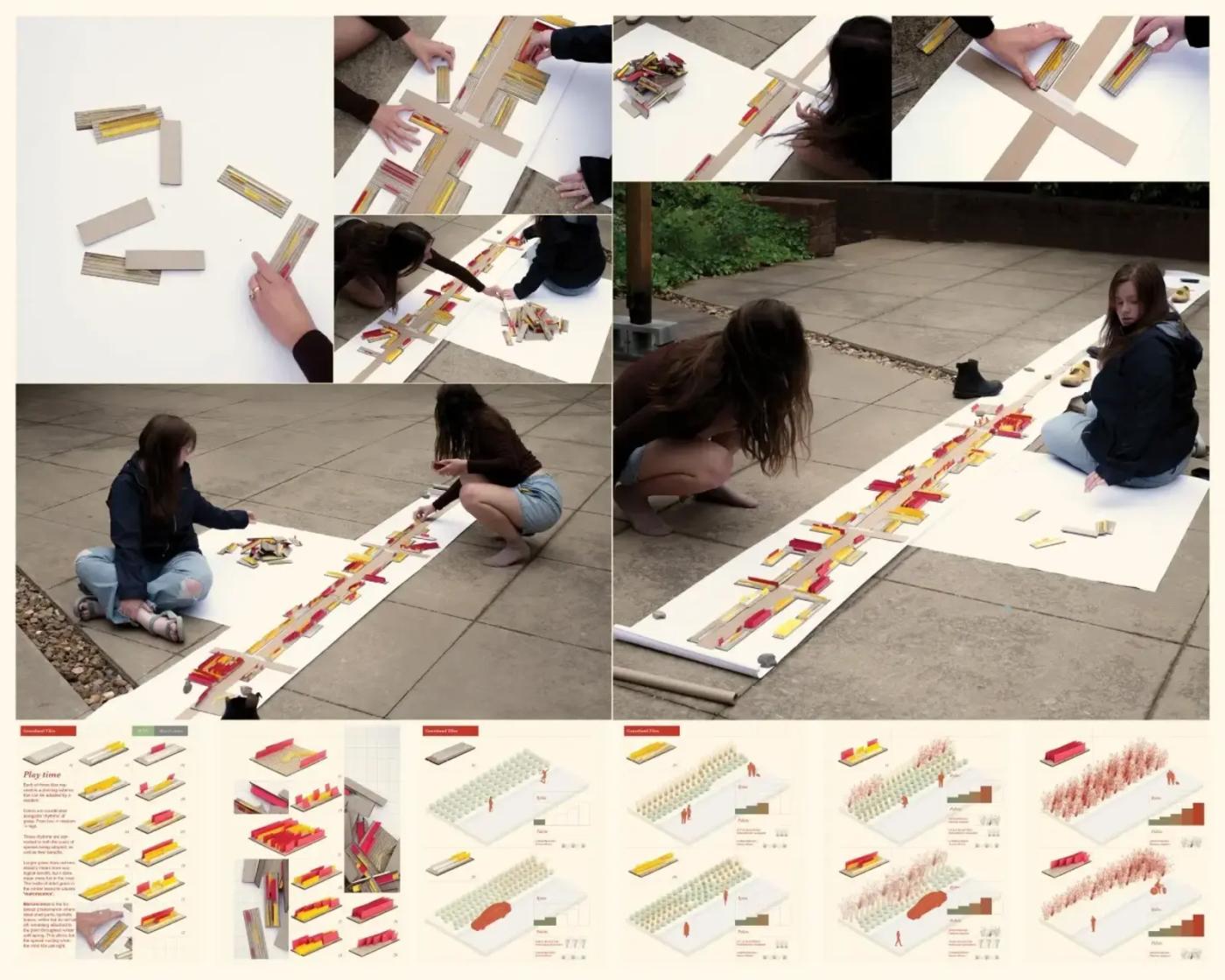
This toolkit gives agency back to residents through a menu of modular planting tiles, framed with orderly edges so that long grasses read as intention, not neglect. The act of letting native grasses grow where lawn once dominated becomes a quiet act of civil disobedience. At the heart of this effort lies a key beneficiary, the Bethany Beach firefly. Through the efforts of proposed bug snugs and informal "snug walls," we give residents designated drop-off spots for leaf litter and their once-a-year grass cuttings. These deposits become an ideal habitat for the endangered firefly, heralding a new and memorable future for Shadownawn residents.
|
Image
|
Image
|
|
Image
|
Image
|
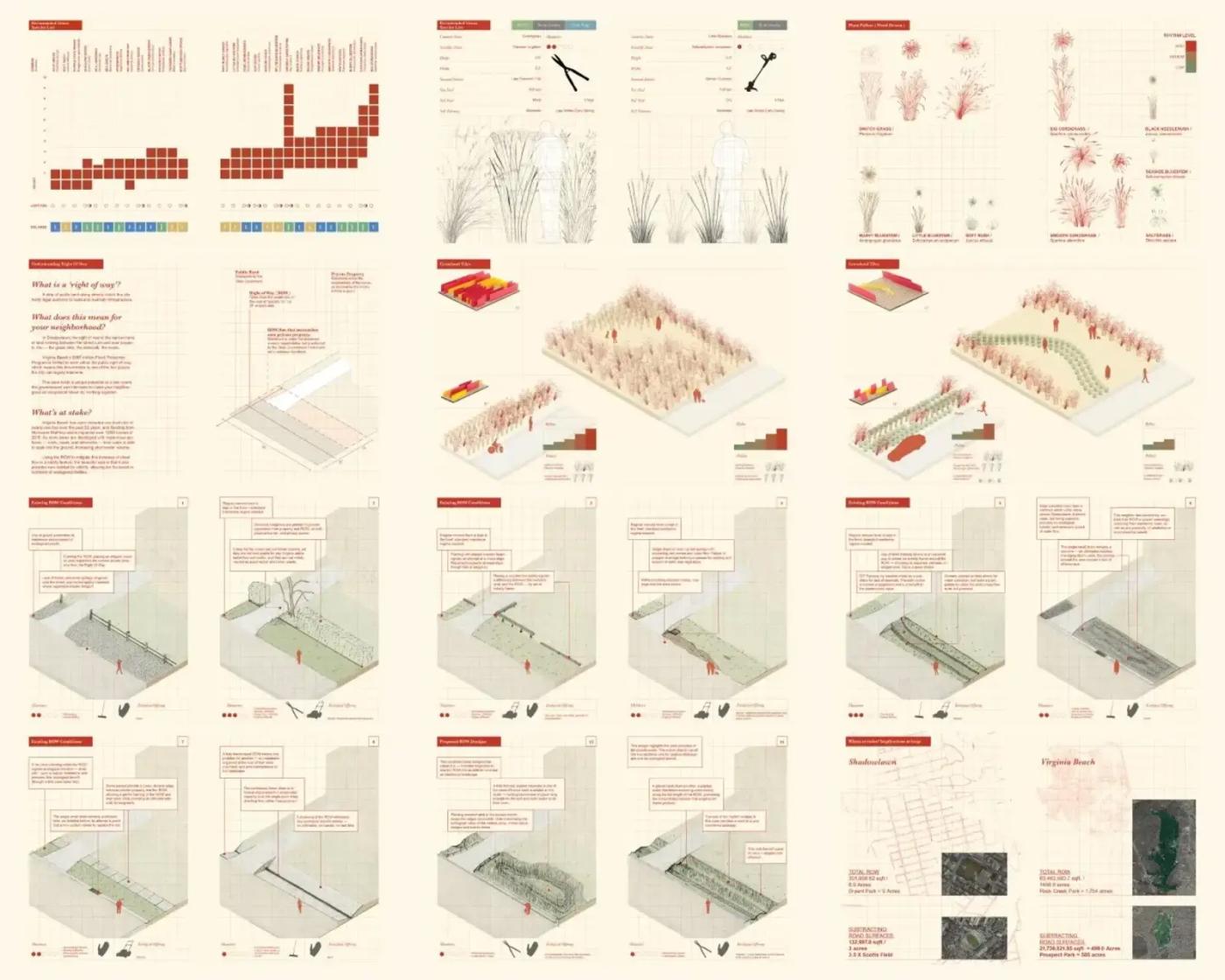
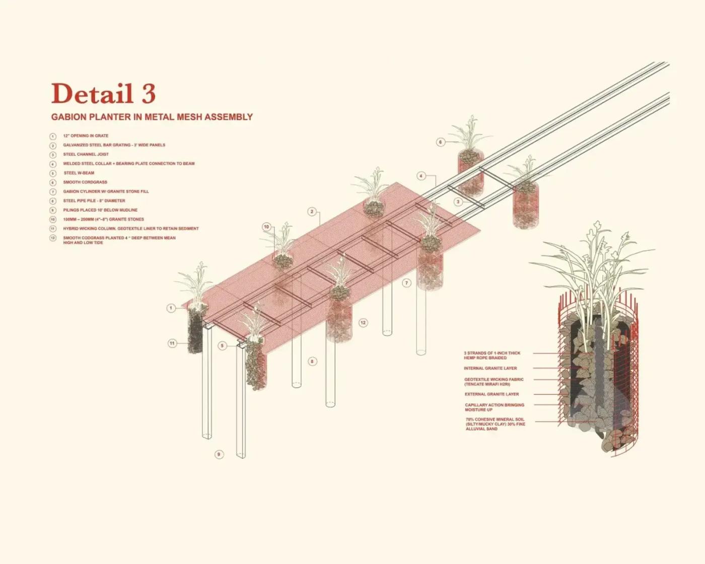
| (top left) Large scale process model allows for group members to plan and assemble grass palettes to visualize mass scale planted arrangements for residents. (top right) Recommended grasses list catalogue. © Michael John Minutoli (bottom left) Material detail—gabion planter mesh assembly; (bottom right) material detail—paving assembly: a lookout across Lake Holly is signaled by intentional paving design to slow cars and pedestrians alike. © Lindsey Messer | |
Virginia Beach has seen nearly a foot of sea level rise in fifty years. Through Virginia Beach's Flood Protection Program, the right-of-way becomes a legal intervention point where seepage basins, double bioswales, and native plantings transform front-yard strips into living stormwater infrastructure, reducing runoff, rebuilding soil ecology, and proving that flood resilience and neighborhood beauty are not in opposition.
The design traces a transect from Lake Holly to Marshview Park. Granite pavers slow traffic; a new bridge reconnects a divided community; gabion cylinder planters line the path with native grasses as living privacy screens. The sequence builds toward crescendos—circular parklet frames holding monocultures from the recommended grass palette, where residents and visitors alike find wonder in what was once dismissed. The trail ends at Marshview Park, opening to marsh views, gathering spaces, and wooden boardwalks shared by neighbors, children, and dogs alike.
Individually, these lots and strips are points of tension. Together, they compose a portrait of hope—proof, visible to every resident and child on the block, that when neighbors work in concert, even the most neglected land can be coaxed into something luminous, just like the fireflies this neighborhood seeks to resurrect along this quiet, unassuming street.
HONOR AWARD—
SEAN ALBERTS, MLA '25; SACHIDA PRADHAN, MLA '24; SHUAI YUAN, MLA '25
|
Image

|
ANALYSIS & PLANNING CATEGORY—
SAXIS 2090: FROM RESISTANCE TO RESILIENCE THROUGH DREDGED LANDSCAPES
Faculty Advisors—Bradley Cantrell, ASLA; Sean Kois
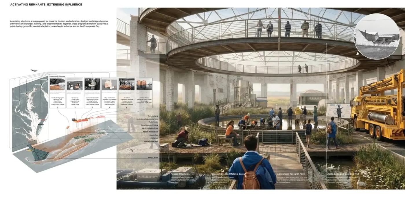
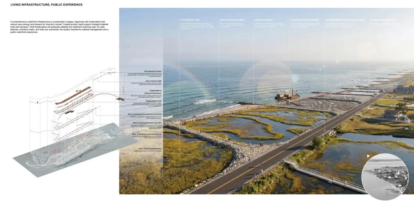
Saxis 2090 proposes a phased coastal adaptation framework for Saxis, Virginia, by reframing dredged sediment as a design medium in response to sea-level rise. At the fragile edge of the Chesapeake Bay, Saxis faces accelerating flooding and erosion that threaten its future. The project redirects sediment from navigation channels to slow erosion, support marsh migration, and reshape the ground over time. Moving beyond static defense, it links landscape transformation with managed retreat, creating time and flexibility for relocation decisions.
Image
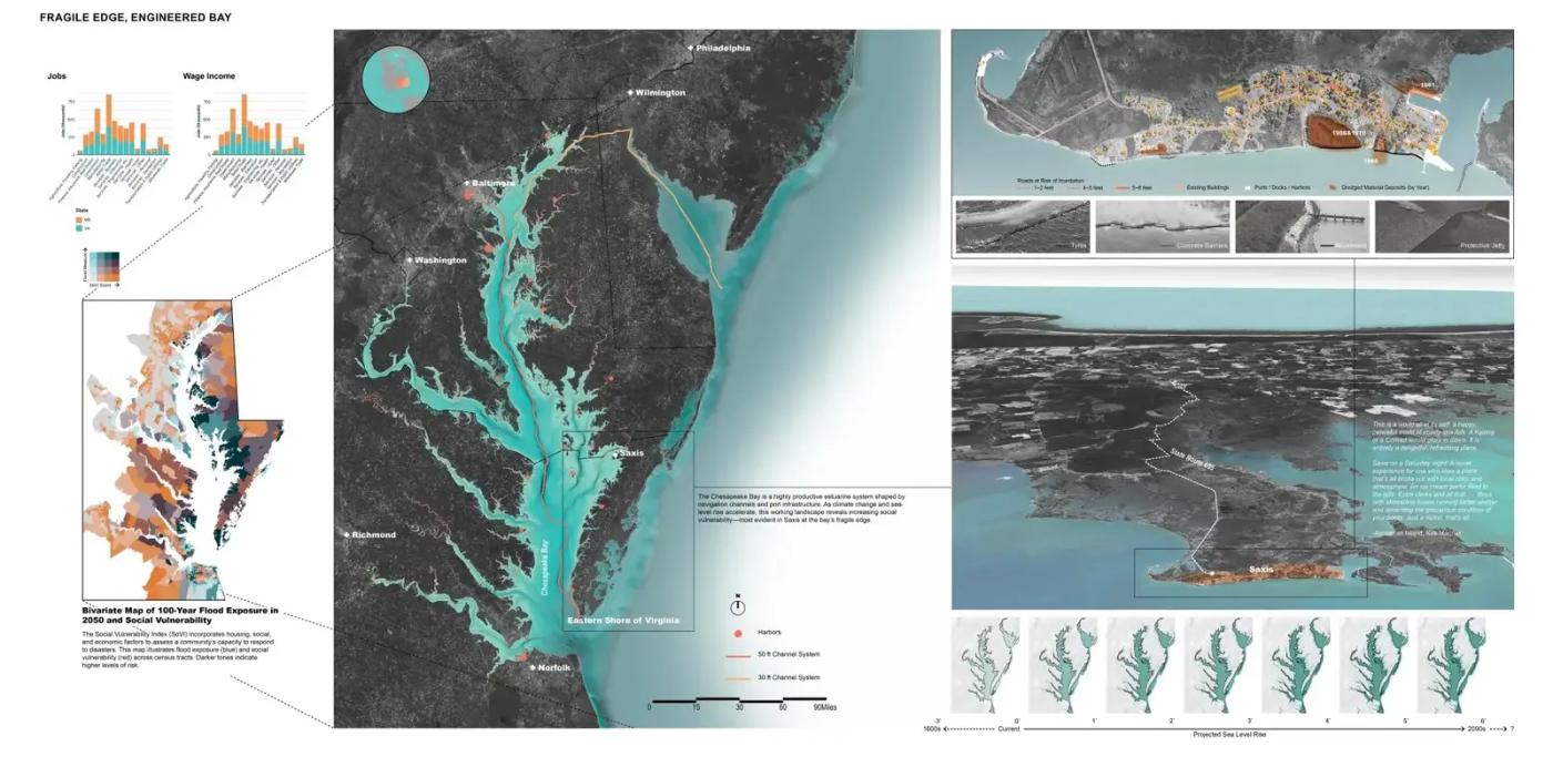
At the frontline of sea-level rise in the Chesapeake Bay, Saxis, Virginia, faces the erosion of its land, livelihood, and identity. With much of Saxis less than two feet above sea level, accelerating shoreline loss and recurrent tidal flooding expose the limits of conventional protection methods.
|
Image
|
|
Image
|
|
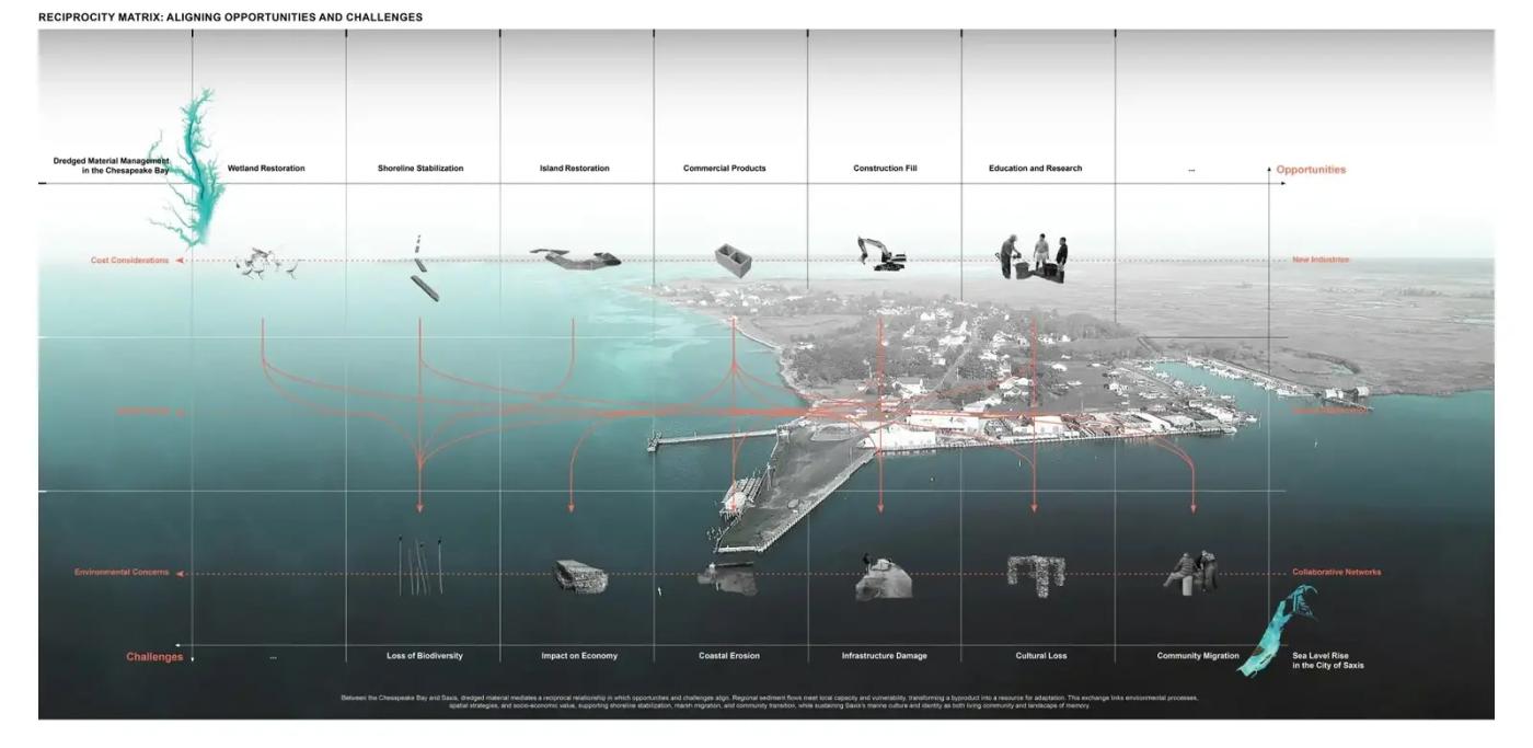
| (top) Fragile Edge, Engineered Bay | At the edge of the Chesapeake Bay, Saxis reveals the tension between engineered productivity and growing vulnerability under rising seas. (bottom) Reciprocity Matrix: Aligning Opportunities and Challenges | Between the Chesapeake Bay and Saxis, dredged material mediates opportunity and challenge, shaping a reciprocal landscape of exchange and adaptation. © Shuai Yuan | |
This project positions dredged material as both a design medium and adaptive infrastructure for coastal resilience. Rather than relying on static defense, it frames Saxis as a dynamic system shaped by sediment flows, hydrodynamics, and socio-political conditions. Coordinated across agencies and stakeholders, these flows generate spatial and financial capacity to support phased relocation and guide Saxis's gradual transition from an inhabited town toward an adaptive marsh landscape.
Saxis 2090 reframes coastal resilience as adaptive rather than defensive, shifting from static protection toward evolving landscape systems. Ecologically, it enables marsh migration and habitat formation; socially, it supports coordinated relocation while maintaining continuity; culturally, it carries memory through evolving landforms. As both a testing ground for climate adaptation and a living maritime archive within the Chesapeake Bay, the project offers a transferable model for coastal transition under uncertainty.
Image
This is an important topic in the built environment I wish more people were talking about. The proposed design solutions were reasonable and inspired. I commend you on making a complicated subject legible.
— Awards Jury
HONOR AWARD—
LINCOLN LANDON LEWIS, PHD CANDIDATE; WILLIAM PACKWOOD, BS ARCH '25
|
Image
|
RESEARCH CATEGORY—
TANGIER ISLAND WATERMEN WORKING LANDSCAPE
Faculty Advisors—Barbara Brown Wilson, Erin Putalik, Tanya Denckla Cobb, Elizabeth Meyer, FASLA, Karen McGlathery
Tangier is the last community in Virginia's portion of the Chesapeake Bay. The remote island has a recorded history dating back to the 1600s and relies on the unique working landscape of the watermen to catch blue crabs. However, the island's tangible and intangible history faces existential risk due to dynamic environmental change. The student team documented the working landscape for the Historic American Landscapes Survey (HALS) Challenge and won first prize. Unique fieldwork methods were developed for analyzing this tidal landscape in addition to the laser scanning of structures and oral history interviews of community members. National Park Service staff credit the submission for expanding the definition of American working landscapes.
Image
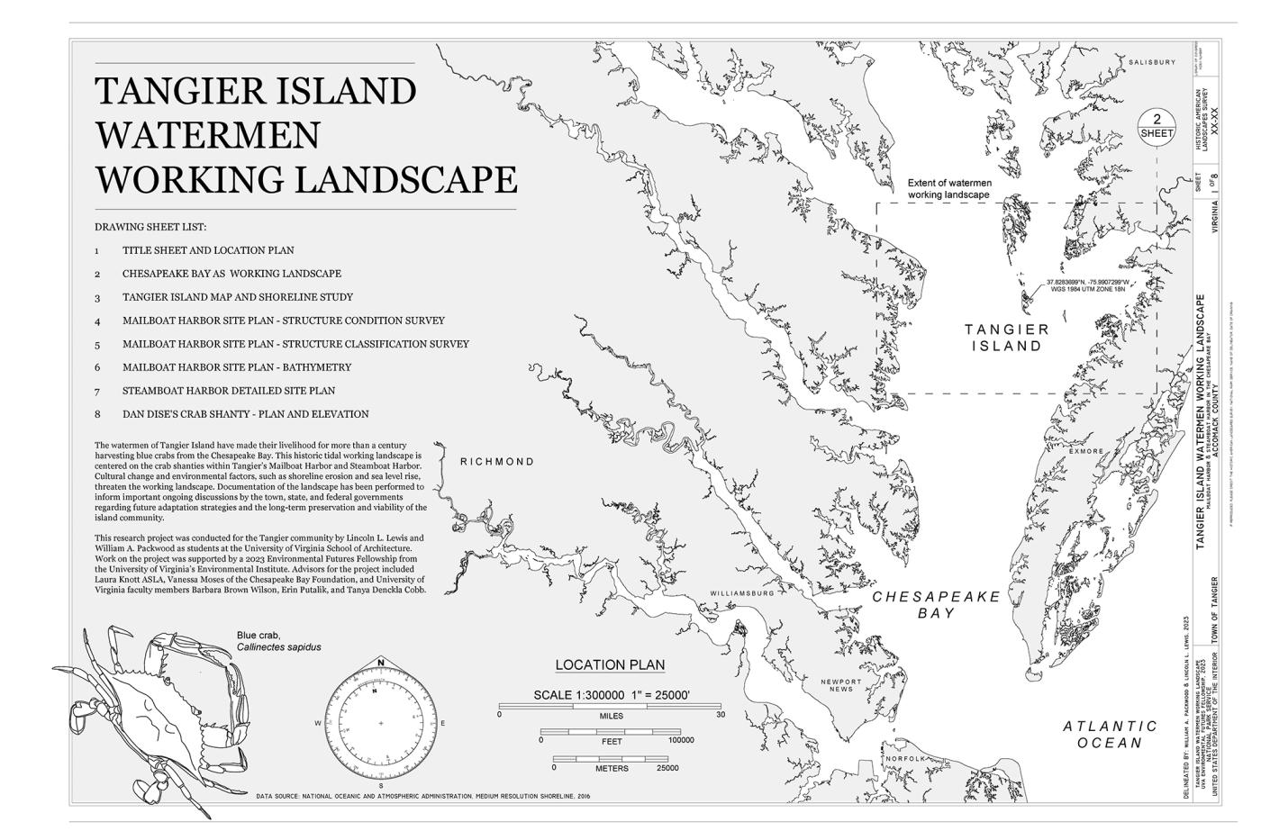
The remote island with 300 residents has a recorded history dating back to the 1600s and relies on the unique working landscape of the watermen to catch blue crabs. Because of this, Tangier is known as the soft shelled crab capital of the world. However, the island's tangible and intangible history faces existential risk due to dynamic demographic and environmental change happening to the island due to erosion caused by wave action, geologic subsidence, and tidal flooding. These impacts have made Tangier one of the most threatened landscapes on the eastern coast of the United States.
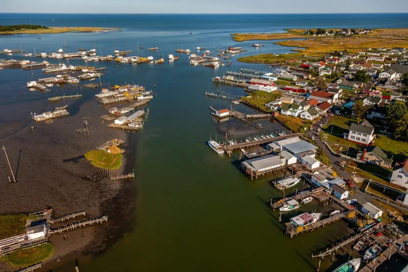
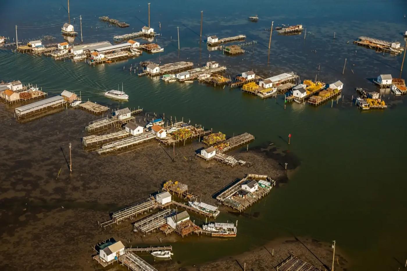
Tangier Island is made up of three low-lying islets surrounding Mailboat Harbor. In this area the watermen have their vernacular "crab houses". These houses are suspended over tidal water and form a unique architectural typology to enable the crab molting process. An early insight from this research was that these important structures were captured in the state's historic resources inventory of Tangier. This demonstrated an important gap to be urgently filled.
Image
The students began their research during the summer of 2023. Subsequently the project won first place in the National Park Service's Historic American Landscapes Survey (HALS) Challenge – an annual competition open to both seasoned professionals and students. That year's theme focused on working landscapes. The Tangier documentation project was impressively credited by the National Park Service with expanding the definition of working landscapes in the United States.
Unique fieldwork methods were developed to analyze the tidal landscape. Archival research at museums was conducted and a spatial inventory of submerged aquatic vegetation (eel grass) and three marsh grasses was also completed.
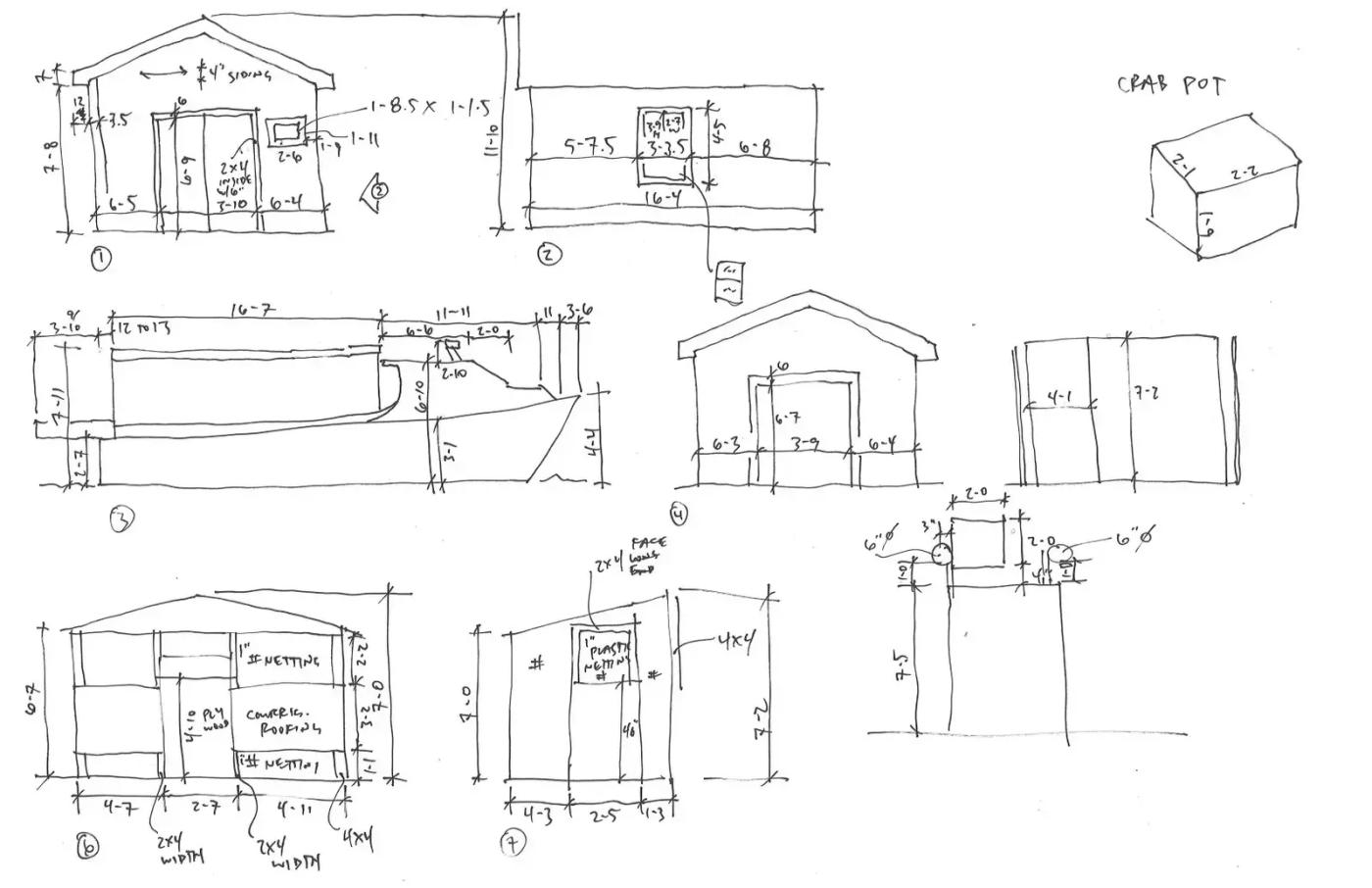
The project utilized nested drawing scales to capture the working landscape. In total 82 crab houses were documented and their conditions analyzed. The research substantiated that the houses were not considered historic because elements were periodically destroyed due to storms or gradual biofouling and rot and did not reach 50 years of age. However, the research demonstrated that elements of the structures were indeed that age or greater.
Image
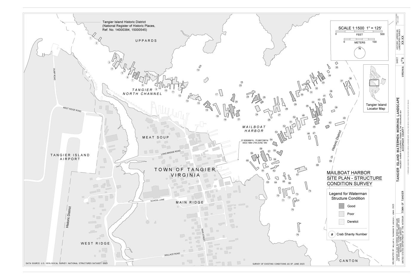
Since the students' initial research during the summer of 2023, they have continued to document Tangier Island with materials which are included in this submission. Oral history interviews were also conducted to capture intangible aspects of the landscape and record the construction methods of the crab houses.
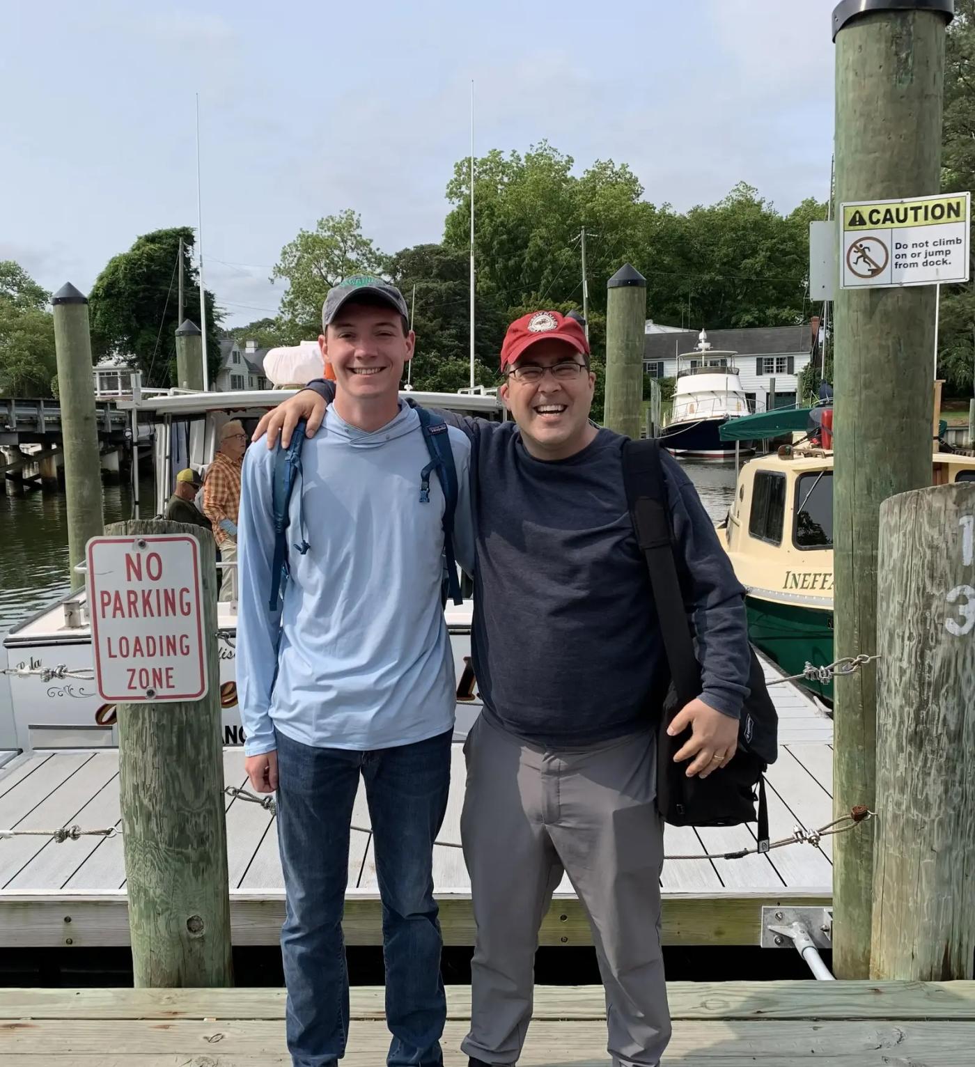
Importantly, the students carried out extensive engagement activities and built strong connections with Tangier's residents in this close-knit community. One of the students has moved to the island for his dissertation research focusing on how coastal communities—especially those with historic cultural landscape assets - plan for the future amidst dynamic environmental change.
|
Image
|
Image
|
| (left) Mailboat Harbor looking southeast as seen from above the western dredged channel with Main Ridge visible on the right. (right) The crab houses of Tangier, Virginia. © Gordon Campbell, At Altitude Gallery | |
Project Credits:
Laura Knott, ASLA—Advisor ASLA Virginia HALS Chapter Liaison
Vanessa Moses—Advisor, Chesapeake Bay Foundation
Katy Clune—Virginia Humanities, Virginia Folklife Program
Gordon Campbell—Photographer, At Altitude Gallery
Bill Heline—Volunteer Logistics Assistance
Paulette Heline—Volunteer Logistics Assistance
Irene Arifin—Volunteer Logistics Assistance
Eleanor Lewis—Volunteer Logistics Assistance
Brookelyn Mitchell—Funding Supervisor
Robin Carleton—Transcriber
Beautiful drawings and detailed research.
— Awards Jury